

Dr Monica Rivas Casaldo, senior lecturer in Integrated Environmental Monitoring at Cranfield University, discusses how Unmanned Aerial Vehicles (UAVs) can quickly capture data on urban flooding to give an accurate picture of property damage – meaning interventions to limit damage can be made immediately.
The average annual cost of flood damage to property in England is more than £1bn and rising. One in six properties are at risk, and the average cost of the repairs for each property ranges between £10,000 and £50,000.
It’s a cycle of threats, misery and repairs that’s exacerbated by the time involved in assessing costs for insurance claims. Residential and commercial property owners are advised not to undertake any clearing up activity until the damage has been assessed by the insurance company, which is time-consuming and costly to undertake. There can be substantial further costs if any dwellings become uninhabitable and the residents have to move into alternative accommodation.
There needs to be detailed understanding of the likelihood of flooding, its likely magnitude and impact in order for there to be the most reliable and effective insurance provision available, with appropriate premiums, excess and loss adjustment. Costs for property owners can be mitigated by adopting different measures, such as resilience and resistance measures (flood guards, hard floor surfaces and waterproof plaster etc) and by making use of insurance products that spread the risk and ensure coverage to as many properties as possible. These will typically cost in the range of £3000 to £10,000 but can significantly reduce the impact of flooding.
Current flood damage assessment by the insurance industry following an event relies on a combination of door-to-door inspections and remote sensing techniques. Many Canadian insurers, for example, use satellite imagery pre- and post-event to assess risk exposure, estimate the number of claims in an area and assess the need for loss adjusters. Similarly, Swiss Re relies on CatNet, a software system that overlays satellite images onto Google maps enabling an assessment of the extent of the flooded area to be made and to determine where claims will arise. But there are a number of factors that limit the effectiveness of remote sensing methods: spatio-temporal coverage may not be available for the required zone and period; optical imagery cannot provide information if there is low cloud cover; satellite data that can penetrate cloud cover has an oblique viewing angle which makes it difficult to discriminate water from other urban features. Also, current remote sensing approaches don’t provide enough detail to assess the effects of micro-topography in streets and the presence of property flood resistance measures.
New results from a study of the use of Unmanned Aerial Vehicles to capture data on urban flooding has demonstrated their potential as a more effective alternative. UAV aerial imagery offers both timely (on-demand) and increasingly detailed (higher resolution) information than comparable satellite or aircraft imagery. UAVs can also be deployed to assist in the response to flooding in conditions and areas that are not accessible by manned aircraft or helicopters. In the last five years, the use of UAV technology has increased exponentially with a varied range of commercial platforms (rotary blade, fixed wing, and nano and hybrid drones) and sensors. An estimated 600 UAVs were used globally in 2015 by police, firefighters, humanitarian relief, and disaster management, with the number being used doubling on a yearly basis.
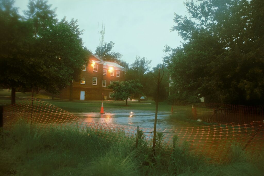
Initial research was carried out at the time of the major Cockermouth flooding at the end of 2015. As a result of storm Desmond, a total of 466 properties were flooded due to flood risk management structures being overtopped and outflanked. The event was a consequence of heavy rainfall over an extended period with more than 300 mm of rain falling over a 24 hour period, which translated into flows in the Derwent River of 395 m3 s−1 at the Ouse Bridge gauging station and 170 m3 s−1 at the Cocker Southwaite River gauging station. The estimated annual exceedance probability for the observed event was less than 1% for both rainfall and river flows.
A fixed wing platform UAV was selected for the survey to maximise area coverage under the rainy and gusty conditions. The Sirius-Pro platform had a 163 cm wingspan and a length of 120 cm, able to fly for up to 50 minutes, and equipped with a16 megapixel Panasonic GX-1 on-board camera. Images were used to identify the flood impact and extent, with each point being assigned a confidence level (high, medium, or low) describing the uncertainty associated with its impact classification and the potential for the impact to have been generated from any other source rather than flood. The raw UAV high-resolution imagery was used to reduce the level of uncertainty when possible. The resulting flood impact point database was used to identify residential property that could have been flooded during Desmond.
The direct tangible losses (domestic clean-up, household inventory damage, and building fabric damage) for the affected properties were calculated using a UK specific methodology. The losses (without VAT or other indirect taxes) for a residential property of a given type and age (for example, pre-1919 detached, 1975–1985 semi-detached, and 1919–1944 flat) were estimated based on the flood water depth within the property. Residential properties with directly observable resistance measures (i.e., flood aperture guards for doors and windows, flood resistant airbricks, and raised doors or steps leading to a property) were also taken into account, alongside the type of flooding (overbank topping, pluvial run-off, and groundwater) affecting the property.
The results from the UAV analysis were compared with those from the classic door-to-door approach (assumed to deliver 100% accuracy). The UAV framework was found to provide an accuracy in the detection of flooded properties of 84%. The results also highlighted the importance of considering all sources of flooding even when an event is largely thought to be fluvial in nature. It is important in the initial evaluation of an event to consider flooding from all sources not just from the overtopping of flood risk management structures. There were significant levels of pluvial and lateral flow flooding, with a total of £3.6 million in direct tangible losses assigned to 168 properties outside the fluvial flood extent. This comprises 36% of the total direct tangible losses associated with all sources of flooding in Cockermouth during this event. These properties were not initially identified as being flooded as the initial responses focused on the fluvial flood extent. Resistance measures present within the area resulted in a considerable reduction in direct tangible losses (£4 million). The work presented here also highlighted the importance in selecting accurate remote sensing loss-adjustment approaches, with a discrepancy in direct tangible losses between the two approaches tested of around £1 million.
The UAV approach will facilitate a better and faster estimation of the extent and impact of a flooding event, a more rapid evaluation of the affected area and the associated damage costs, also enabling loss adjusters to prioritise their individual household impact assessments. What’s needed now is further development of the system to allow for a more automated process and near-real-time data.
The full research article was published as ‘The Use of Unmanned Aerial Vehicles to Estimate Direct Tangible Losses to Residential Properties from Flood Events: A Case Study of Cockermouth Following the Desmond Storm’ in Remote Sensing 2018.