


How walking and cycling can be used to pave the way for new homes
Across the UK, the pressure is on to deliver more affordable homes. Homeownership is now the preserve of a minority. The private rented sector hosts a larger share of UK households than in recent history, with a cloud of uncertainty that comes with renting hanging over swathes of the British public.
Nowhere is this more acutely felt than in London. And the capital’s mayor, Sadiq Khan, is focused on tackling this housing crisis.
But what has this got to do with walking and cycling, you ask? Potentially a lot. Here’s why.
New homes and better transport go hand in hand
In London, the planning system rightly restricts new development to where there is public transport capacity or committed improvements.
It is claimed, for example, that Crossrail 2 would help unlock 200,000 new homes by connecting sites where new homes could be built into the transport system. Without it, those sites would be restricted to low density suburban sprawl. Too far from services and jobs to be worth the investment and reliant on cars to get around London’s already congested and polluted streets.
With a new Crossrail 2 station nearby, it becomes possible to set aside land for homes, employment and other uses without the car dependency that would threaten their viability. See the Northern Line extension to Battersea Power Station or the overground’s extension to Barking Riverside for other examples. It’s in this way that big rail projects and new development go hand in hand.
But big rail transport takes a long time and a lot of money. The mayor’s target of 50,000 new homes per year – potentially more in his next plan – would mean Crossrail 2 delivers four years’ worth of the housing target, despite billions in investment and financing and decades in planning and construction.
This means that alongside these mega-projects we need to find quicker and more readily fundable ways of delivering transport improvements that unlock new development opportunities in London.
Walking and cycling: a more cost-effective way to move people around
Yes, it’s an obvious answer from a Sustrans employee, but schemes that transform streets, roads and paths whilst enabling people to walk and cycle are substantially cheaper than new roads or railways.
Due to their scale, they can also be delivered more quickly. As London’s high-quality cycling network reaches further across the capital, new sections can plug into the wider network relatively easily.
The trouble is that at the moment, the main transport tool that helps to guide development doesn’t take cycling into account. This tool – Public Transport Accessibility Levels (PTAL) – creates a colour coded heat map of London showing how accessible public transport is by foot.
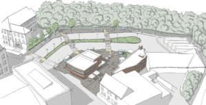
Rightly, this system helps to ensure dense development is limited to areas of good public transport access (while also limiting car parking). Think of Stratford, for example, a place whose meteoric redevelopment was unlocked by major transport investment.
If we add cycling in too, the map changes dramatically. Areas of high access to public transport expand and areas of poor access shrink. The implications of this is increased opportunities for denser development across much of London, contributing to the housing and employment demands of a growing population.
But this technical change does nothing to the actual conditions on the ground that determine whether people might cycle or walk, or not.
That’s why we envision the tool being used to leverage investment in walking and cycling schemes – and London’s overall cycling network – to ensure that those places are actually connected by foot and by bike in a way that people will use them over the car. And to a certain extent this isn’t new.
Car-free lifestyles
Whether by design or pure chance there are parts of London where the transport mix has people living happily car-free lifestyles despite being quite far from the public transport network. In inner London, in particular, there are a number of areas that are relatively far from public transport but have relatively high cycling and walking levels. These are the areas where having and using a car is an expensive headache.
We believe the planning system can do more to learn from this and create development where walking and cycling are a delight, car use is restricted and public transport within reasonable reach.
Moving it forward
Incorporating cycling into the PTAL system could start to identify places where this approach could work. Used in the way we envision, it would help to secure the much needed investment in infrastructure from new developments (something local authorities want) in return for slight increases in density (something developers want). In doing so this new approach would increase the funding available for Healthy Streets and for the construction of London’s network of high-quality bike routes.
The next step is to create a tool to guide development in areas of London where public transport is really poor, but cycling and walking show huge potential. Something we call ‘Active Travel Accessibility Levels’. But before we create a new tool, there’s huge potential from updating our existing tools.
This is just one of the proposals in our new report that looks at ways the mayor’s forthcoming draft London Plan can harness new development for the mutual benefit of public health, environment and housing growth. Read the report on Sustrans’ website here.
Photo by londoncyclist 
