One of the most severe environmental disasters of the war so far, the destruction of Kakhovka Dam disrupted water supplies,threatened livelihoods and devastated ecosystems. But advanced satellite imagery now shows the environment is healing and adapting at a startling rate.
The Kakhovka Dam on the Dnipro River in southern Ukraine was crucial for irrigation, energy generation, and ecosystem balance. Its destruction in June 2023 due to Russian aggression caused severe flooding, environmental damage, and disrupted agriculture, posing challenges for farmers dependent on consistent water supplies. In response, EOS Data Analytics [EOSDA] provided vital satellite-based tools and insights to assess and address the crisis’s impact on the environment.
EOS Data Analytics specialiszes in satellite-driven solutions for precision farming, forestry, and environmental research. By leveraging advanced remote sensing technology, EOSDA provides live satellite maps and actionable insights to help users optimiseseize resource management and minimize environmental harm. EOSDA’s Crop Monitoring platform provides farmers with real-time data on crop health, soil moisture levels, and weather trends, helping them make informed decisions even under extreme conditions.
Serhii Klimov’s Study On Soil Water Stress Using EOSDA Tools
Beyond the immediate ruining effects, the destruction of the Kakhovka Dam disrupted the irrigation systems critical to agriculture in Ukraine’s Kherson region, a dry area reliant on the dam for crop water supply. The long-term implications for agriculture, particularly soil water stress, required detailed analysis to understand and address.
Serhii Klimov, a professor at the National University of Water and Environmental Engineering in Ukraine, investigated these impacts using EOSDA Crop Monitoring, a satellite-powered platform providing recent satellite images and real-time data on vegetation health and soil conditions. Klimov focused on a group of fields in the Kherson region, analyzing water stress levels and potential crop losses caused by the dam’s destruction. The findings reveal significant drops in soil and crop health, especially in Crimea and southern Ukraine, where agricultural productivity has been severely affected.
By reviewing the 2022 growing season data — before the dam’s collapse — Klimov used indices like NDVI (Normaliszed Difference Vegetation Index) and NDMI (Normaliszed Difference Moisture Index) to identify changes in soil moisture and vegetation health. His findings revealed that without irrigation, over 23% of fields showed significant water stress early in the season, with this figure rising as the season progressed. Soil productivity, heavily reliant on controlled irrigation, deteriorated sharply, underscoring the risk of desertification without intervention.
Remote Sensing: Key To Ecological Sustainability
Klimov’s research demonstrated the invaluable role of remote sensing tools. The EOSDA Crop Monitoring platform enabled large-scale analysis without physical field inspections, offering actionable insights for managing water resources and planning land restoration using live satellite view. As Klimov noted:, “I like your platforms because virtually anyone can use them. There is no need to have special knowledge to understand everything. The indices and legends are explained in great detail.” This research highlighted the critical need for innovative solutions in crisis management and sustainable farming practices, emphasiszing the role of technology in mitigating the effects of environmental disasters.
From Ruins To Renewal: Life After Kakhovka Dam Destruction
The destruction of the Kakhovka Dam marked one of Ukraine’s most severe environmental disasters, devastating ecosystems, disrupting water supplies, and threatening livelihoods. Yet, a year later, signs of remarkable natural recovery are emerging. What was once the Kakhovka Reservoir has begun transforming into a new ecosystem, with willow forests covering a third of its area and wildlife (wild boars, roe deer, and hares) returning. The Great Meadow (Velykyi Luh), submerged for decades, is reemerging, offering hope for regeneration.
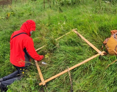
Apart from discovering soil water stress, EOSDA scientists also studied the current satellite imagery of the Great Meadow and documented rapid natural recovery, with new vegetation flourishing in the previously submerged areas. Ecologist Vadym Maniuk emphasisesz]ses the opportunity to study and support this unique regeneration process, warning against hasty infrastructure projects.,
‘Just imagine the scale of the ecosystem services the Great Meadow could provide — from large-scale carbon capture and oxygen production by forests to the region’s potential to supply fish and timber,’ said Maniuk.
Similarly, expert Oleksii Angurets advocates for sustainable solutions, such as modern irrigation technologies, to balance ecological preservation with human needs. ‘We can’t just turn back the clock. We need to consider the evolving needs of both nature and the people who depend on its resources.’
EOSDA’s research highlights the importance of monitoring these changes using satellite views of the Earth. By combining satellite insights with ecological expertise, they aim to inform sustainable development in the region. This story is not just about nature’s resilience but also about humanity’s responsibility to learn from the past and protect emerging ecosystems. The Great Meadow could become a symbol of rebirth, reminding us of our collective role in shaping a sustainable future.
Maksym Sushchuk has over 15 years of experience in commercial writing and journalism. His work is dedicated to fostering positive change in society, ecology and the environment, using compelling narratives to inspire action and drive sustainable impact.
More features:
The Blueprint Coalition: empowering local authorities to lead on climate action
Gridlocked: UK renewable goals demand competition in the energy transmission network
Water stewardship is key to a sustainable future, but lacks leadership
Image: EOSDA


